Positioning and Dating by Satellite
The PDS Community of Experts deals with the techniques and technologies implemented for positioning and dating by satellite. The various terrestrial, maritime and aerial fields are explored.
Scope
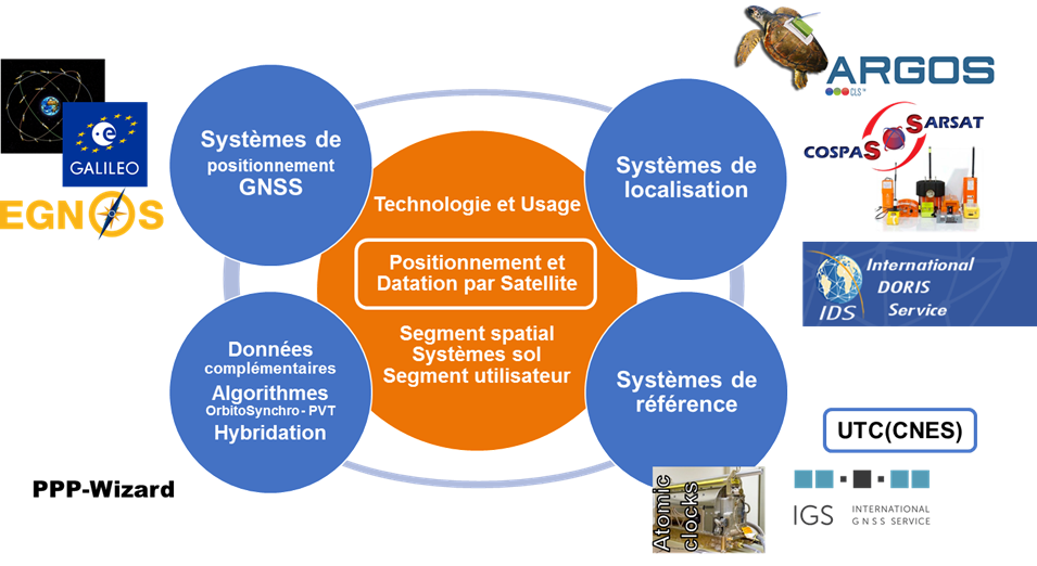
The systems at the core of this Community are on one hand GNSS (Global Navigation Satellite Systems), such as GALILEO, GPS, GLONASS, BEIDOU and their regional augmentation systems EGNOS, WAAS, MSAS, GAGAN, etc., and on the other hand the location space systems such as ARGOS, COSPAS-SARSAT or DORIS.
The Community also deals with international time and geodetic reference systems (UTC, ITRF) to which GNSS systems and location systems are necessarily attached.
The various positioning modes are approached, statically or dynamically, including the use of complementary data: satellite-based augmentation systems (SBAS), differential GPS, Real-Time Kinematics (RTK), precise point positioning (PPP) global corrections and Assisted-GNSS, as well as receiver-specific algorithms: RAIM (Receiver Autonomous Integrity Monitoring) and hybridisation with other techniques (telecommunication methods, RFID, MEMs).


